Mississauga’s Landscape Remembers
/
I have always said that a landscape remembers. People have shaped our landscape, and have been shaped by our landscape, for hundreds of years and countless generations. Some of our oldest connections between present and past landscapes can be found (if you know what to look for) through historic survey lines visible on modern aerial imagery. It helps to reinforce the thought that wherever you live, walk or drive, someone has walked there before us, maybe even hundreds of years before us.

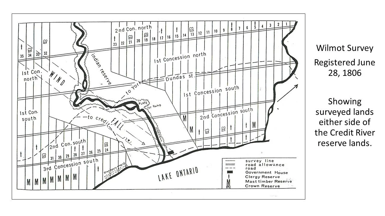
Following Provisional Agreement 13-A in 1805 and the signing of Treaty 14 in 1806, Samuel Wilmot undertook the first government survey of Toronto Township (historic Mississauga). The survey was registered on June 28, 1806. However, Treaty 14 set aside one mile on each side of the Credit River, from Lake Ontario to what is today Eglinton Avenue. This two-mile strip of land was not part of Wilmot’s 1806 survey.
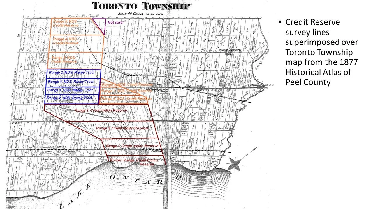
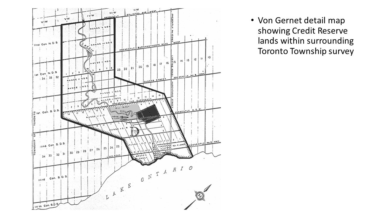
Because the river meanders slightly as it winds its way southwards, the land that was reserved for the Indigenous Mississaugas of the Credit also roughly followed its irregular course. The Wilmot survey followed a regular British cadastral grid system establishing long, rectangular-shaped 200-acre lots. It was a survey of right angles. Problem was that the Credit River did not conform to the cadastral survey. So, there were places where the rectangular grid of the survey ran into the angled lines of the reserve lands set aside in the treaties (these reserve lands would become known as the Credit Indian Reserve).
Much of the reserve lands were opened for survey and settlement after 1846, but even all of these years later, that meeting between the old Wilmot survey and the reserve lands can still be found on our modern landscape – even if things got a bit muddled on the maps when both sides of the reserve lands were surveyed and settled. But the reminders still peak through, more then 200 years later.
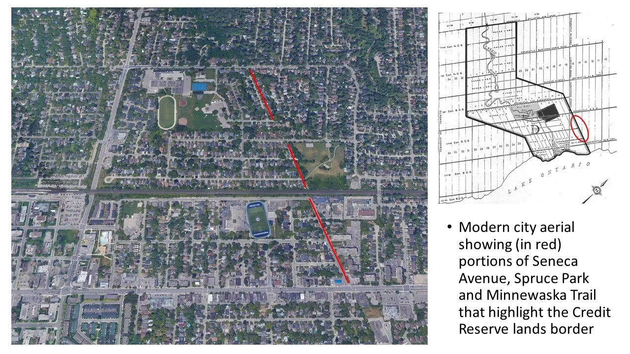
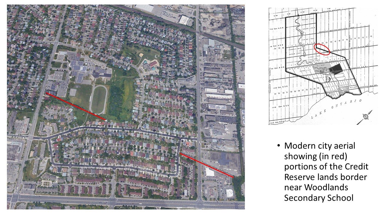
If you zoom out on an aerial survey on the east side of the Credit River in the Port Credit and Mineola East area and trace the lines of Seneca Avenue, the west border of Spruce Park and Minnewaska Trail, you can clearly see the old survey division between the Wilmot Survey and the Credit Indian Reserve lands. A portion of this survey line is also visible near The Woodlands Secondary School on the east side of Erindale Station Road.
Further north, parts of modern Perivale Road and Rathkeale Road (together these were the original route of Creditview Road) also mark a portion of the survey division. The former McConnell Road (its route ran parallel to Highway 403 between Creditview Road and Fifth Line West, now Erin Mills Parkway) is also shown in the early surveys, as does the north entrance to the UTM campus and Harkiss Road, as does Blythe Road. Mineola Road east and west also mark the historic division between Range 1 and Range 2 of the Credit Indian Reserve lands.

On the west side of the Credit River, a “jog” in Fifth Line West (which marked part of the one-mile limit) is seen today in Fowler Court, while a more visually identifiable survey division can be found with a portion of Indian Road. Godfrey’s Lane, on the west side of Port Credit adjacent to Brueckner Rhododendron Gardens also follows the “angled” alignment of the Credit Indian Reserve.

Clear as mud, right? But it does show us the marks made on the landscape have a way of staying with us over time, clearly linking our modern city to its historic roots, even if in a very subtle way.