A Tale of Two Dixies in Mississauga
/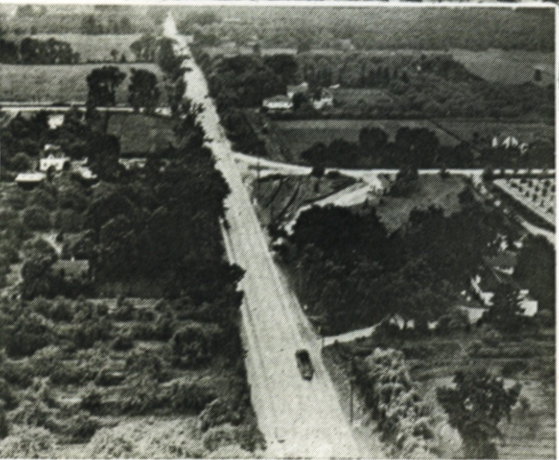
Jog of Dixie Road at the Middle Road - QEW, 1941 - prior to bypass
You can almost picture it. Over the warm summer months of 1806, some 217 years ago, a surveying crew headed out into the wilds of historic Mississauga after sheltering the night before at the Government Inn in what is now Port Credit. Their task was to bring a cadastral order to the landscape – to lay out lots, concessions, and road rights-of-way before colonial settlers began drawing their land grants and settling here. It would have been a daunting task, and not without some peril – there are references to swamps, swarms of mosquitoes, and wild animals such as wolves and bears to contend with. To be clear, we do not know entirely what the surveying process entailed in terms of tasks, crew members, numbers, and duration, although some parts of the process have been passed down.

Samuel Street Wilmot - Surveyor
The “Old Survey” of Toronto Township (Mississauga) was led by Deputy Surveyor General Samuel Street Wilmot (1774-1856). His team had just completed the survey of nearby Trafalgar Township (registered June 28, 1806), and now had their sights (and survey chains) set on historic Mississauga. The surveying crew set out from the Government Inn for the Etobicoke Creek. Once there, it is recorded that the crew split into two teams, using the already laid out Dundas Street as their centre line. One crew started in the north at a distance of six miles from the Lake Ontario shoreline at the Etobicoke Creek and were to work their way southward. Another crew started at the shoreline and would work their way north. The southern crew reportedly faced more obstacles in the way of floodplains and marshes.
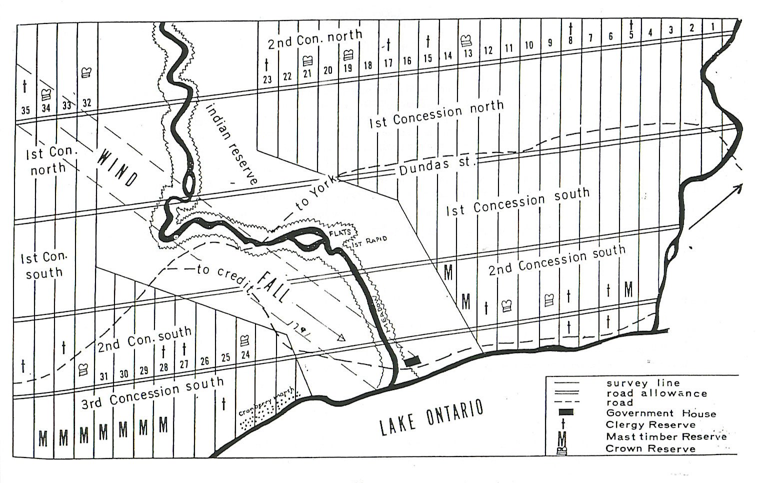
Samuel Wilmot's Map - copy of 1806 survey plan - Old Survey
The survey crews typically involved a lead surveyor, eight axemen and two chain bearers. So, for two crews, there were likely around 20 to 22 people involved. Some also employed Indigenous guides, although we do not know for certain if Wilmot retained guides for this survey. It was not an easy operation to outfit or oversee, particularly as the two crews would have been separated while out in the field. We do not currently know who the names of the other people involved in conducting the actual survey were, other than Samuel Street Wilmot.
Queens Rangers surveying and clearing road alignment by CW Jefferys
The six-mile mark inland from the mouth of the Etobicoke Creek is marked today by Eglinton Avenue (formerly known as the Base Line – another reference to early surveys). From this point, the north crew began laying out the lots and concessions southward from the base line. The south crew began working northwards from the lake. Between every fifth lot was a road allowance, but there appears to have been some confusion, likely arising from the broken lots along the Etobicoke Creek – the creek of course did not conform to the right angles of the survey, creating an irregular border. The crews intended to meet “in the middle” – what would become the Middle Road, later the QEW. Problem was, with the first road allowance (now known as Dixie Road, previously Third Line East), the crews did not exactly “meet” – that is, the road allowances did not line up, with the north section being located a half lot further to the east than the south section of the road.

Dr Beaumont Wilson Bowen Dixie c1860
Surveys are funny things sometimes as they can leave permanent reminders on our landscape. The surveyors did not attempt to “fix” the “mistake”. They continued on. The next road allowance, now known as Cawthra Road, did not line up at the middle line either, although the sections were closer together than the sections of Dixie Road were. You can still see the “jog” in Cawthra Road as you pass over the QEW today. However, the misalignment of Dixie Road is much more apparent. The Dixie Road bypass was built over the QEW in 1951 to connect the north and south sections of Dixie Road, and that bypass is still with us today, connecting the two sections of the road allowances that were first surveyed in the summer of 1806 – a permanent “oops” on our landscape.

Crop from 1877 Historical Atlas of Peel County showing survey jog of Dixie Road at the Middle Road
And that brings us to our story of two Dixies – as you travel southward on Dixie Road today and come to the bypass at Sherway Drive, you turn right to continue on your way along Dixie Road over the QEW and beyond. However, if you do not turn right and continue straight along the road before it ends at the North Service Road, this is also Dixie Road – the original Dixie Road from before the 1951 bypass was built. This little stub or remnant of Dixie Road was not renamed, and so for a short distance there are two separate sections called Dixie Road. The name of “Dixie Road” was officially applied, south of Dundas Street, in 1927 and is named in honour of beloved local doctor Beaumont Wilson Bowen Dixie (1819-1898).
When the bypass was built in 1951, the south side of Dixie Road was also realigned, albeit slightly. The older section of Dixie Road on the south side of the QEW was renamed – it became known as Cormack Crescent. If it was not renamed, like its orphaned counterpart on the north side, we might have had three sections all named Dixie Road, and that would have been a tad more confusing!
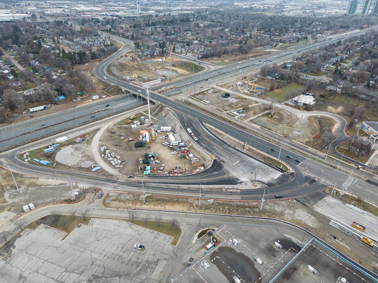
Dixie Road at the QEW