Fifth Line West – A Ghost on the Mississauga Landscape
/
Fifth Line West was originally surveyed as part of the 1806 Wilmot Survey (“Old Survey”), running from Lakeshore Road to (almost) Eglinton Avenue. The southern section, south of the Middle Road (now the QEW) we know today as Southdown Road. Just north of the QEW, Fifth Line “jogged” slightly to the west – this jog is still there today and is now known as Fowler Court. When the route for Erin Mills Parkway was created, running north from Southdown Road and the QEW in the 1970s, it bypassed this “jog” in Fifth Line West.
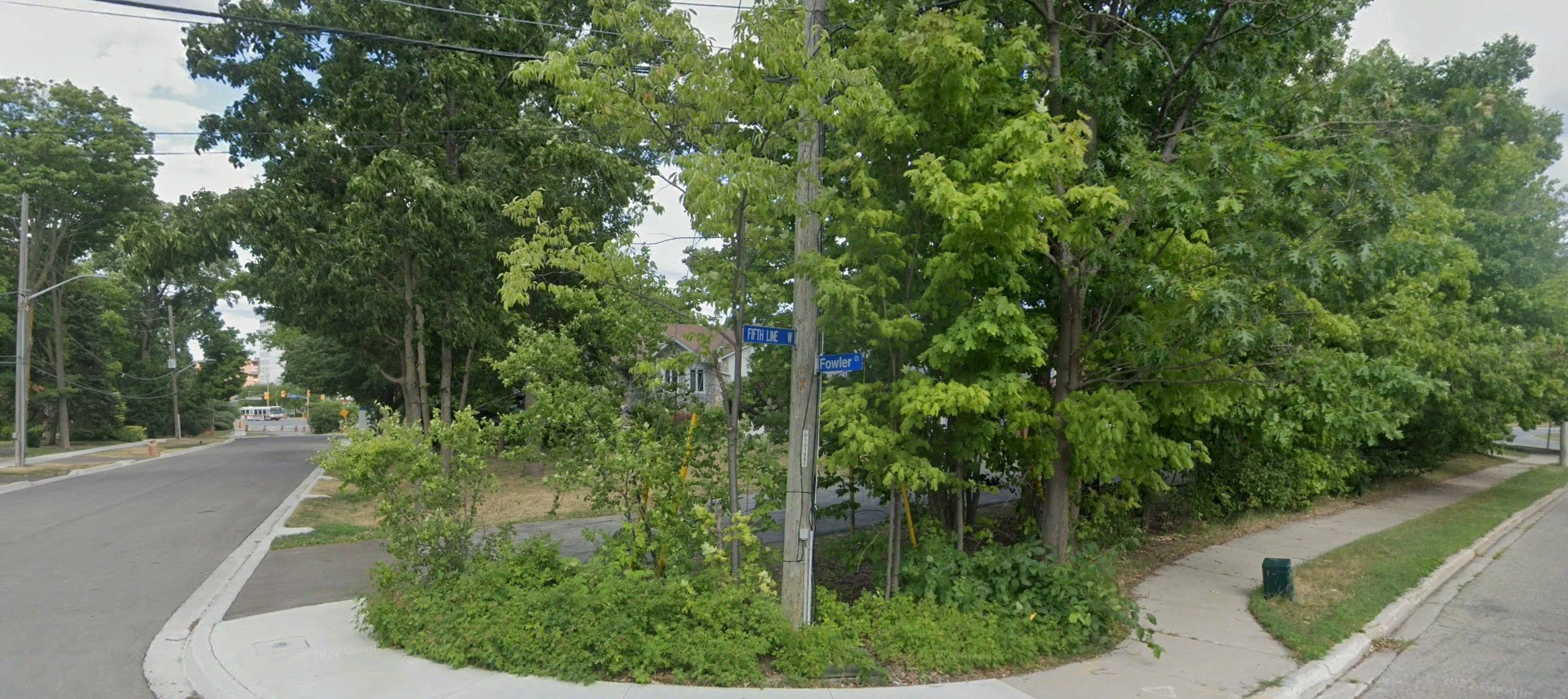
Fifth Line and Fowler
As this initial section of Erin Mills Parkway created a new route, Fifth Line West continued on its original course, tracing a much older route northwards than new, albeit parallel, Erin Mills Parkway. Fifth Line West ends today at South Millway as a result of Erin Mills Parkway making its own “jog” and “taking over” the original course of Fifth Line West north of South Millway. The only identifiable and named part of Fifth Line West today runs from Leanne Boulevard (north of the QEW and Fowler Court) to South Millway. This traces a route of travel that has been part of our landscape for more than 200 years now.

Old Burnhamthorpe Road and Fifth Line West
Historically Fifth Line West was opened as far as Burnhamthorpe Road – well, sort of. The Fifth Line right of way continued north to Eglinton Avenue but was only opened for travel as far as historic Burnhamthorpe Road (which is a short distance to the north of the modern route of Burnhamthorpe Road and is marked today by Rogers Road and Burbank Road). The area was a swampy valley due to Sawmill Creek, and for part of its history the travelled route came to an abrupt stop at the Dunn farm – marked today by Dunn Park and the Millennium Grove. Fifth Line West, although a surveyed right-of-way, was not opened for travel between the Dunn Farm (south of the modern Highway 403) to Eglinton Avenue.

Fifth Line West north of Battleford Road, 1954
The northern section of Fifth Line West, running north from Eglinton Avenue, was part of the 1819 Bristol Survey (“New Survey”). It was opened for travel, but it did not line up exactly with the older the southern right-of-way. These two sections of Fifth Line were not connected until Erin Mills Parkway was put through, largely overlaying the route of Fifth Line as it went northwards, at least until Battleford Road. (Well, for the most part. Erin Mills Parkway did have to “bend” slightly around the existing Vista Heights subdivision – modern Turney Drive follows a portion of the original course of Fifth Line).

Former route of Fifth Line West
There were some issues, over the years, with Fifth Line becoming washed out and impassable at times where it crossed Wabukayne Creek, north of Britannia Road, although all traces of the valley here have largely disappeared beneath modern Erin Mills Parkway.

Ghost of Fifth Line West route shown in red north of Battleford Road, 2023
To find Fifth Line West today, north of Battleford Road, requires a map and ruler. Draw a straight line from that intersection northward to where it aligns with Meadowvale Boulevard / Heritage Road north of the 401. That is the “ghost” of the forgotten route of Fifth Line West. There are remnants on the landscape that can still be found – paved routes behind factories, a walking path, property lines that are aligned in a straight line, and more. I am told bridge abutments over a small creek still exist, although the road no longer crosses. And a small segment of the route is still readily visible running north from the end of Surveyor Road (itself another name that makes me pause and ponder). North of the 401, Meadowvale Boulevard and Heritage Road follow the route of Fifth Line West.

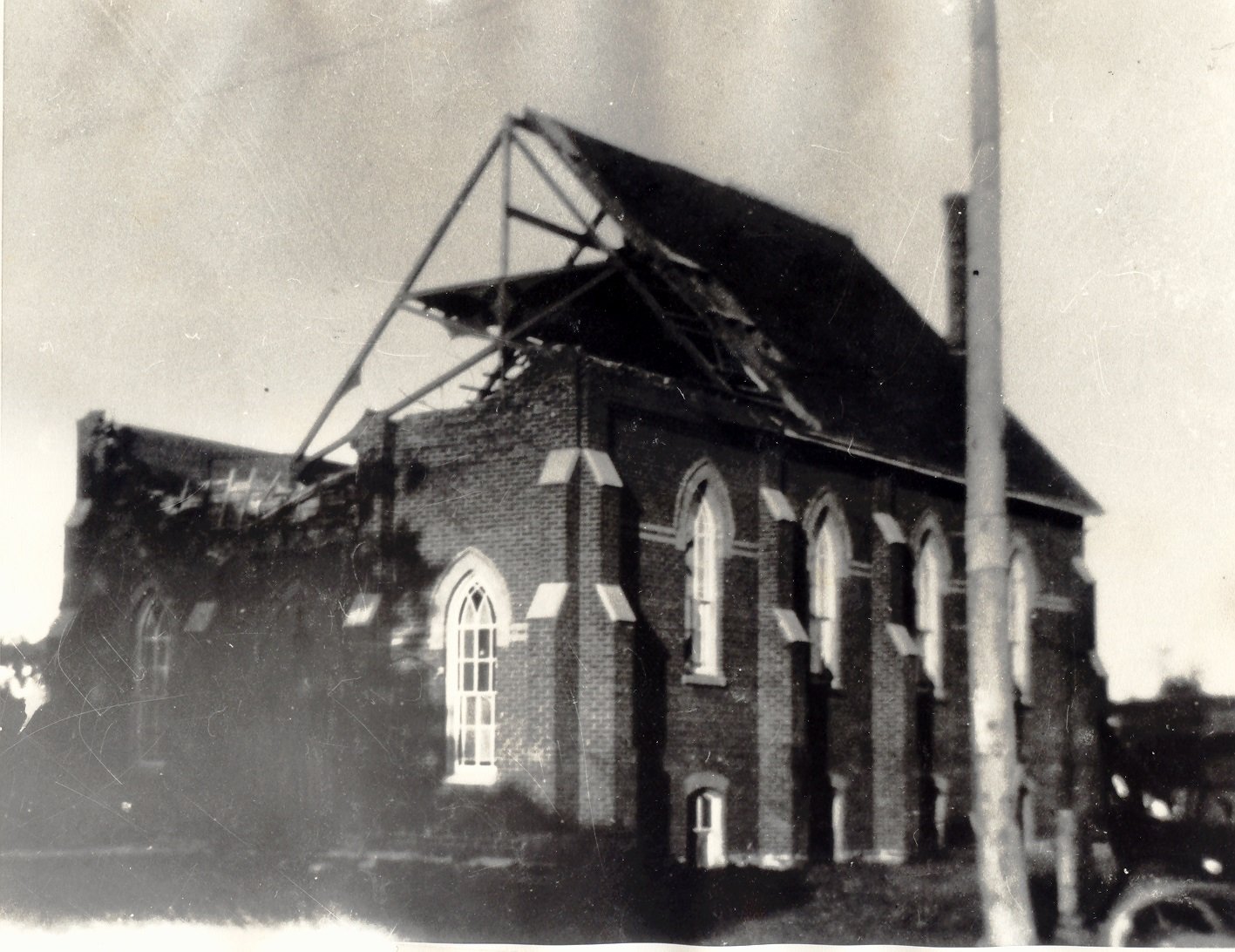
Dunn Farm at Rogers Road and Fifth Line West, c1900
Fifth Line West offers and interesting case study in the evolution of landscape – something hidden in plain view, offering a glimpse at both our past as a largely rural area, and the story of relentless growth and change into a modern City.